Terrain Recognition Game¹)
Translation details
Model:mistral-large-2512.Translated text
Section titled “Translated text”This game reinforces the memorization of topographic symbols and provides practice in drawing them.
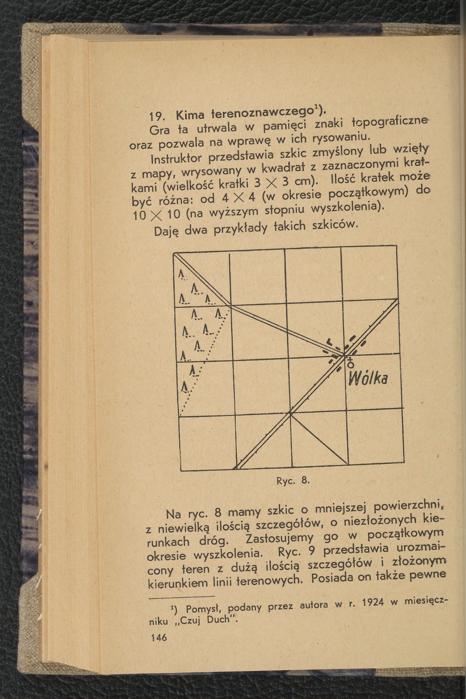
The instructor presents an imaginary sketch or one taken from a map, drawn within a grid of marked squares (square size: 3 × 3 cm). The number of squares may vary: from 4 × 4 (in the initial training period) to 10 × 10 (at a higher level of training).
Two examples of such sketches are provided.
Fig. 8.
In Fig. 8, we have a smaller sketch with few details and uncomplicated road directions. This will be used in the initial training period. Fig. 9 depicts varied terrain with many details and complex terrain line directions. It also contains certain
¹) Idea proposed by the author in the year 1924 in the monthly magazine Czuj Duch.
deficiencies that the youth should detect. (Find them.) This will be a sketch for older youth in the final training period.
Students draw a similar grid in their notebooks, matching the instructor’s sketch (it is possible to announce a reduction scale, such as a twofold or threefold reduction). Depending on the age and skill level of the youth, the instructor initially allows direct copying of the sketch with the goal: “who copies the symbols better.” At a higher level, the game will involve time-limited observation and memory-based copying of the sketch. The youth are allowed to look at the sketch for a set amount of time (5—10 minutes). Once the time is up, they attempt to recreate the observed sketch in their grids. Accuracy in the placement of symbols within the given squares and correct drawing of the symbols is required.
Negative points are assigned for each missing symbol, each incorrect direction or misplacement of a symbol, and each incorrectly drawn symbol. The lowest sum of negative points determines the winner.
Additionally, we will teach drawing and reading symbols as well as terrain relief using the so-called
Source of scan: Polona / National Library, marked “Public Domain.” View scan — image 154.
Metadata
Section titled “Metadata”- Type: game
- Traits: Not stated in the source
- Source: Jan Jasiński, Gry i ćwiczenia terenowe (Harce terenowe) (1938)
- Printed pages: 146–147
- Digital edition: Digital edition · Source record
- Open the edition at the relevant page: p. 146
- Read the source text: gct-085